


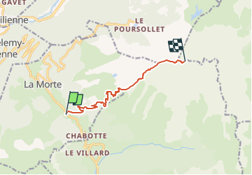
Le Taillefer depart La Morte 1503 +

claude nier
User

Length
8.2 km

Max alt
2851 m

Uphill gradient
1503 m
Km-Effort
23 km

Min alt
1366 m

Downhill gradient
23 m
Boucle
No
Creation date :
2022-08-06 11:34:30.101
Updated on :
2022-08-06 11:36:10.022
5h17
Difficulty : Medium

FREE GPS app for hiking
 SityTrail
IGN / Geographical institutes
SityTrail Plus
The world is yours!
About
Trail On foot of 8.2 km to be discovered at Auvergne-Rhône-Alpes, Isère, La Morte. This trail is proposed by claude nier.
Description
Petite rando sympa
longue et pas facile
Etre en forme imperatif
Positioning
Country:
France
Region :
Auvergne-Rhône-Alpes
Department/Province :
Isère
Municipality :
La Morte
Location:
Unknown
Start:(Dec)
Start:(UTM)
725769 ; 4989279 (31T) N.
Comments